
Garmin GPS 76 Handheld GPS Navigator
4.6Editor score
WAAS enabled GPS receiver
Up to 16 hours battery
1 MB memory for maps
Finding the right marine GPS unit is essential for safe and efficient navigation on the water. Whether you are a casual angler or a serious sailor you need reliable tools to track your location avoid hazards and find your way back to shore without getting lost.
We have carefully compared ten leading models based on their display quality mapping capabilities connectivity options and overall ease of use. Each product was evaluated for its ability to perform in real-world marine conditions ensuring you get accurate information when it matters most.
Every pick highlights specific strengths and ideal use cases to help you narrow down your options quickly. Please note that product availability and pricing can change frequently so verify current details before making your final purchase decision today.
4.6Editor score

4.4Editor score

5.0Editor score
As an Amazon Associate we earn from qualifying purchases.
The following table provides a side-by-side comparison of all ten marine GPS units reviewed in this guide. Use this overview to quickly identify key specifications and features that align with your specific boating needs and preferences.

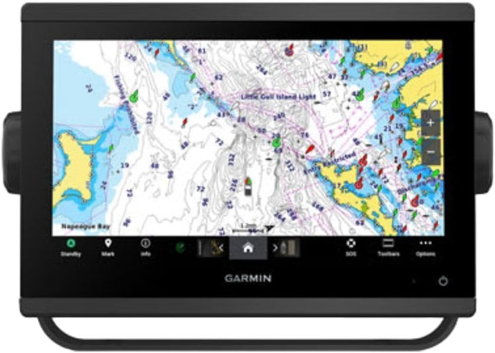


The Simrad GO Chartplotter stands out as a versatile multifunction display designed for sportboats and smaller cruisers. It combines GPS navigation with robust sonar capabilities to offer a complete solution for anglers and captains alike.
We may earn a commission when you buy through this link, at no additional cost to you.
Its included C-MAP Discover card provides high-resolution bathymetric contours and vector charts covering the US and Canada. The HDI transducer supports clear CHIRP sonar and DownScan Imaging to help you identify bottom structure and fish targets effectively.
While the unit offers extensive connectivity via Wi-Fi and NMEA 2000 some users might find the initial system integration requires patience. Additionally radar functionality is an optional add-on rather than a built-in feature for this specific model.
This device is ideal for boaters who need reliable navigation and fish-finding tools without spending on a full premium system. Its balance of features and integration options makes it a strong contender for various recreational boating needs.
The C-MAP Discover card delivers custom depth shading and tidal data for better route planning.
You can mirror the display to a smartphone or tablet for remote viewing around the boat.
We may earn a commission when you buy through this link, at no additional cost to you.
The Garmin ECHOMAP UHD2 94sv offers a bright and clear touchscreen display that is easy to read even in direct sunlight. This chartplotter comes with a GT56 transducer and Navionics+ coastal charts for immediate use out of the box.
We may earn a commission when you buy through this link, at no additional cost to you.
Its improved detail and viewing angles make navigation intuitive while the built-in Wi-Fi allows wireless sharing of waypoints and sonar data with other units. It also connects wirelessly to Force trolling motors for advanced route following and speed control.
The main drawback is the cost which may be steep for casual users who do not need advanced motor integration features. The reliance on specific motor brands for certain wireless functions limits flexibility for those with third-party equipment.
This model is perfect for boaters who prioritize a high-quality display and seamless connectivity with compatible motors. The user-friendly interface ensures you can focus on navigation rather than fighting with complex menus or settings.
Traditional ClearVü and SideVü scanning sonars provide detailed views below and beside the boat.
Wirelessly share sonar and routes between multiple ECHOMAP UHD2 chartplotters on your vessel.
We may earn a commission when you buy through this link, at no additional cost to you.
This Garmin GPSMAP unit focuses heavily on delivering ultra high-definition scanning sonar performance for serious anglers. It is built to support Panoptix sonar which offers real-time views of the water column even while moving at speed.
We may earn a commission when you buy through this link, at no additional cost to you.
The pre-loaded mapping ensures you have immediate access to detailed charts without needing to download them first. The display optics are improved for better visibility in various lighting conditions making it easier to interpret sonar images on the water.
While the base unit is powerful the full potential of the Panoptix support requires additional investments in specific sonar transducers. This can make the total system cost much higher than the initial price tag suggests for new buyers.
If you demand the highest resolution imaging for locating fish and structure this unit provides a solid foundation. It is best suited for dedicated fishermen who are willing to invest in the ecosystem for maximum performance and clarity.
Support for Panoptix sonar lets you see fish and structure in real-time while underway.
Improved optics ensure the screen remains clear and readable in bright sunlight and shade.
We may earn a commission when you buy through this link, at no additional cost to you.
This large chartplotter is designed for complex marine systems where engine data and digital switching are crucial. It supports OneHelm digital switching and allows you to connect third-party devices for a fully integrated boat management solution.
We may earn a commission when you buy through this link, at no additional cost to you.
With preloaded Navionics+ charts you have detailed mapping coverage right out of the box. The ability to check your boat's built-in sonar features and control the marine experience remotely adds significant convenience for serious boaters.
The complexity of connecting various engines and digital systems means professional installation is often recommended. The high price point also reflects its positioning as a premium solution for larger vessels with advanced electronic needs.
For owners of boats with extensive electronic systems this unit provides a central hub for control and monitoring. It is an excellent choice for those who want a unified interface to manage engine data radar and navigation together.
Connect third-party devices via OneHelm digital switching to manage boat systems from one screen.
Control your marine experience remotely for easier operation while on the water or at home.
We may earn a commission when you buy through this link, at no additional cost to you.
The Garmin GPSMAP 79sc is a rugged handheld GPS designed to float and resist water damage with an IPX6 rating. It comes preloaded with BlueChart g3 coastal charts which is a significant advantage over many other handheld units.
We may earn a commission when you buy through this link, at no additional cost to you.
With increased memory you can save and track ten thousand waypoints and three hundred routes for extended trips. The built-in compass and barometric altimeter provide reliable navigation data even if you are standing still on the deck.
The screen is relatively small compared to fixed mount chartplotters which can make map reading difficult in some lighting. Users should also be aware that updating the included charts may require additional purchases over time.
This device is perfect for smaller boats or as a backup unit on larger vessels where a fixed mount is not available. The combination of ruggedness floating design and included charts makes it a practical tool for personal safety.
Supports multiple satellite constellations like GPS GLONASS and Galileo for global tracking accuracy.
The rugged design floats in water and resists damage ensuring you do not lose it overboard.
We may earn a commission when you buy through this link, at no additional cost to you.
This handheld GPS offers a simpler alternative with a worldwide basemap that covers land and water across the globe. It shares the rugged design and float capabilities of the 79sc but lacks detailed coastal charts out of the box.
We may earn a commission when you buy through this link, at no additional cost to you.
The device tracks your position using multiple satellite constellations to ensure reliable navigation anywhere in the world. Its memory allows you to record significant waypoints and routes while the battery life supports up to twenty hours of continuous use.
The lack of detailed coastal charts means you may need to purchase add-on maps for specific water areas. However the price point is lower making it an attractive option for those who just need basic position tracking.
Ideal for casual boaters or hikers who need a dependable GPS without paying for advanced marine chart features. Its lightweight and rugged build ensure it can handle outdoor adventures without fear of damage or loss.
The worldwide basemap provides land and water coverage globally without needing regional updates.
Up to twenty hours of battery life in GPS mode keeps you safe on longer excursions.
We may earn a commission when you buy through this link, at no additional cost to you.
The GPSMAP1022XSV provides a ten inch screen for navigation and sonar display but does not include a transducer. This allows buyers to choose their own sensor later which offers flexibility but adds to the initial setup cost.
We may earn a commission when you buy through this link, at no additional cost to you.
The display is bright and clear making it easy to read charts and waypoints even in challenging light conditions. It serves as a solid combination unit for those who already have a transducer or plan to buy one soon.
Users should be aware that without a transducer the unit functions primarily as a chartplotter until the sonar is added. This can be a downside for immediate fish-finding needs but works well for navigation focused setups.
This model is suitable for boaters who want a large screen for navigation and plan to customize their sonar setup. It offers a good balance of hardware quality and flexibility for those willing to invest in additional components.
Buyers can select their preferred transducer later to tailor the system to their fishing style.
The ten inch screen provides ample space to view maps and data simultaneously without clutter.
We may earn a commission when you buy through this link, at no additional cost to you.
This classic handheld GPS provides WAAS enabled accuracy and simple navigation tools for basic marine use. It tracks up to twelve satellites continuously and includes a trip computer to help you monitor speed and distance easily.
We may earn a commission when you buy through this link, at no additional cost to you.
With one megabyte of memory you can download data from optional map sources to expand its capabilities over time. The unit runs on two AA alkaline batteries for up to sixteen hours which is practical for day trips and outings.
The lack of preloaded detailed maps means you will need to add cartography if you want to see coastlines clearly. It is a barebones device that focuses on raw positioning and simple trip management rather than rich visual interfaces.
Ideal for those who need a no-frills navigation tool for emergencies or simple tracking on the water. Its reliability and low cost make it a great backup device for any boat regardless of size or complexity.
The built-in trip computer tracks current speed average speed and trip distance automatically.
WAAS enabled technology ensures high precision positioning for safe navigation on open water.
We may earn a commission when you buy through this link, at no additional cost to you.
This fifteen-inch chartplotter features an IPS panel that delivers a bright and clear view in direct sunlight. It includes high wattage traditional CHIRP sonar and a worldwide basemap for detailed navigation across coastal and inland waters.
We may earn a commission when you buy through this link, at no additional cost to you.
Networking capabilities include NMEA 2000 and J1939 ports which let you connect engines autopilots and digital switching systems. The built-in Wi-Fi and Bluetooth allow you to share charts and data with smartphones and other onboard devices easily.
The large screen size requires significant space on the dashboard which might not suit smaller vessels or boats. The price is high reflecting its premium status but the feature set justifies the cost for serious marine applications.
This unit is designed for captains who need top-tier visibility and integration for complex marine electronics. It offers a comprehensive solution for navigation and fish-finding with room to expand into radar and advanced engine monitoring.
The 5000 watt traditional CHIRP sonar provides excellent target separation in deep water.
NMEA 2000 and J1939 connectivity allow integration with autopilots VHF radios and AIS transponders.
We may earn a commission when you buy through this link, at no additional cost to you.
The GPSMAP 743 offers a compact seven inch screen with Navionics+ mapping for efficient navigation on smaller vessels. It supports Panoptix sonar but does not include a transducer allowing for flexible future upgrades if needed.
We may earn a commission when you buy through this link, at no additional cost to you.
Its pre-loaded mapping provides immediate access to charts while the improved display optics ensure visibility in various conditions. The unit is designed to be easy to install on boats where space is at a premium.
Because it is non-sonar out of the box users must add a compatible transducer to access fish-finding features. This might increase the total cost slightly but keeps the initial purchase price lower for navigation-focused boaters.
This chartplotter is ideal for captains who want reliable navigation on a smaller display without sacrificing mapping quality. It serves as a strong entry point into the Garmin ecosystem for those planning to add sonar later.
The seven inch screen fits easily on dashboards with limited space or smaller helm stations.
Panoptix sonar support allows you to upgrade your system with real-time viewing capabilities later.
We may earn a commission when you buy through this link, at no additional cost to you.
Selecting the right marine GPS unit involves evaluating several key factors to ensure it meets your navigation and safety requirements.
The display size determines how easy it is to read charts and sonar data in bright conditions. Larger screens offer better clarity but take up more space on the dashboard so consider your available mounting area.
Look for sunlight-readable screens with high resolution to ensure you can see details clearly even under direct sun.
Preloaded charts save time and money by providing immediate navigation data without extra downloads. Check if the unit includes regional charts or a worldwide basemap depending on your typical cruising areas.
Consider future update costs and compatibility with premium chart options like Navionics+ or BlueChart g3 for better detail.
If fishing is important look for units with built-in CHIRP or scanning sonar to identify fish and structure accurately. Some models require separate transducers which allows flexibility but adds to the initial cost.
Evaluate whether you need real-time Panoptix sonar or standard DownScan imaging based on your fishing style and budget.
Modern units offer Wi-Fi Bluetooth and NMEA 2000 to connect with other devices on your boat. This allows seamless sharing of data between chartplotters engines and autopilots for better system management.
Ensure the unit supports the specific protocols used by your existing marine electronics to avoid compatibility issues during installation.
Marine GPS devices must withstand harsh weather and accidental splashes so look for high IP ratings like IPX6 or higher. Rugged construction ensures the device survives bumps and drops on the boat.
For handhelds confirm the unit floats in water to prevent loss overboard during rough conditions or accidental slips.
Fixed units draw power from the boat's electrical system but handhelds rely on internal or replaceable batteries. Long battery life is critical for handheld units during extended trips where recharging is difficult.
Check the rated hours of operation and whether the unit supports external power inputs or standard alkaline batteries for convenience.
Touchscreen interfaces are intuitive and fast while button controls offer reliability when wearing gloves or in wet conditions. Choose a layout that feels natural and allows quick access to essential functions while navigating.
Look for simplified menus and customizable layouts to reduce distraction and improve safety while operating the vessel.
Marine GPS units range from basic handhelds to advanced systems with radar and engine integration. Set a realistic budget that balances your needs with the cost of necessary accessories and future upgrades.
Investing in a reputable brand often ensures better software support and resale value over the life of the unit.
Before heading out always power on the unit to allow it to acquire satellite signals and update your current position. Verify that your maps are active and your route waypoints are entered correctly to avoid navigation errors.
Clean the screen regularly with a soft damp cloth to remove salt spray and debris that can reduce visibility. Avoid using harsh chemicals or abrasive materials that might scratch the glass or damage the touch sensors over time.
If you have a handheld device store it in a protective case when not in use to prevent physical damage. Periodically update the software and map data to ensure you have the latest navigation information and security features.
Not all units come with detailed maps preloaded. Some budget handhelds provide only a basic basemap and require you to purchase map cards. High-end chartplotters often include regional charts or a worldwide basemap for immediate use.
A standard GPS provides your coordinates and basic route info. A chartplotter displays those coordinates on a map allowing you to see depth charts routes and waypoints visually. Chartplotters usually support sonar and radar integration for full boating needs.
Yes handheld GPS units are excellent backups for larger chartplotters. They are portable and often float so you can carry them in a safety kit. They ensure you can still navigate if your main system fails or loses power.
Map updates are usually done via a micro SD card or through a USB connection to a computer. Some newer units allow wireless updates over Wi-Fi but check your manual for the specific process and any subscription fees.
Many chartplotters do not include a transducer so you must buy one separately. Models that list Transducer Included come with the hardware. Otherwise check the unit specs to see which transducer types are compatible before purchasing.
For small boats look for compact handhelds or 7 to 9 inch chartplotters that fit easily on limited dashboards. Ensure the unit floats if handheld and has good battery life for day trips without constant recharging.
Most handhelds and advanced chartplotters offer worldwide basemaps or satellite coverage. However detailed coastal charts are region specific so you may need local data cards for specific countries or waters depending on where you sail.
We have reviewed ten top marine GPS units ranging from budget handhelds to premium chartplotters with advanced sonar capabilities. The Simrad GO offers great value while the Garmin 1223xsv leads in display size and integration options.
When choosing a unit prioritize features that match your typical boating activities such as fishing navigation or safety. Consider factors like display size battery life and connectivity to ensure the system works well with your existing equipment.
Prices and availability for these models change frequently so check current listings before making your final decision. Use the comparison table and reviews above to find the right fit for your vessel and budget today.