
Garmin eTrex SE
4.2Editor score
168 hour battery life
Multi-GNSS support
Geocaching Live sync
This guide compares the top handheld GPS units for geocaching in 2026, evaluating display quality, battery life, mapping features, and durability to help
Finding the right handheld GPS for geocaching can transform your outdoor adventures into successful treasure hunts. A reliable device ensures you never lose your way while searching for hidden caches in diverse terrains.
We evaluated ten top-rated GPS units based on display clarity, battery endurance, satellite connectivity, and geocaching-specific features. Each model was analyzed for its ability to handle challenging environments and provide accurate navigation.
Every pick highlights key strengths and weaknesses to help you decide which device fits your style. Please note that prices fluctuate regularly, so check the current listings before making your final purchase decision.
4.2Editor score
4.3Editor score

4.1Editor score
The following table provides a side-by-side comparison of all ten selected GPS units. It highlights essential specifications to help you quickly identify the model that best suits your geocaching needs and budget.





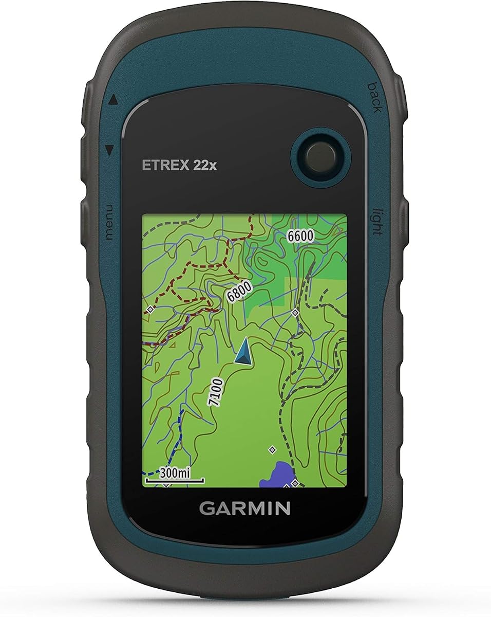
The Garmin eTrex 22x stands out as a top contender for geocaching enthusiasts seeking a reliable and affordable navigation tool. It has earned high ratings for its rugged build and clear display that remains visible even in direct sunlight.
We may earn a commission when you buy through this link, at no additional cost to you.
This device comes preloaded with Topo Active maps that include routable roads and trails, making it easy to plan your route to hidden caches. The support for both GPS and GLONASS satellite systems ensures you maintain a strong signal even in dense forests or deep canyons.
While it lacks a touchscreen interface, the physical buttons offer precise control even with gloved hands. The main trade-off is that it requires two AA batteries which may need frequent replacement during long expeditions compared to rechargeable units.
If you want a dependable device that balances performance and cost without compromising on map quality, this is an excellent choice. It is particularly well-suited for weekend explorers who need accurate tracking and easy waypoint management.
The 2.2-inch color display offers 240 by 320 pixels ensuring maps and coordinates are easy to read under bright outdoor conditions.
With 8 GB of internal memory plus a microSD slot you can store multiple regional maps for extended trips without worrying about space limits.
We may earn a commission when you buy through this link, at no additional cost to you.
The Garmin eTrex SE offers incredible value for its price point with an impressive battery life that lasts up to 168 hours in standard mode. This makes it ideal for multi-day camping trips where recharging is not an option.
We may earn a commission when you buy through this link, at no additional cost to you.
It pairs seamlessly with the Garmin Explore app on your smartphone to provide automatic cache updates from Geocaching Live. This integration allows you to download new cache details and hints wirelessly without needing a computer connection.
The device supports multiple global navigation satellite systems including GPS GLONASS Galileo and BeiDou for improved accuracy in challenging environments. However the display is smaller than premium models which might be difficult for some users to read easily.
Choose this model if you prioritize long-term endurance and connectivity over a large screen. It is a practical choice for budget-conscious adventurers who still demand high reliability and smart features on the trail.
Pairing with the Garmin Explore app enables automatic updates for weather and geocaching data directly to your handheld device without cables.
In expedition mode this unit can last up to 1800 hours ensuring your device remains powered during extremely long duration outdoor adventures.
We may earn a commission when you buy through this link, at no additional cost to you.
The Garmin Montana 680 is a powerhouse for geocaching with over 250000 preloaded worldwide geocaches ready to use right out of the box. This massive database saves you the time of manually entering coordinates for every hunt.
We may earn a commission when you buy through this link, at no additional cost to you.
It features a high-sensitivity WAAS-enabled GPS receiver that locks onto satellites quickly even under heavy tree cover. The included one-year Birdseye Satellite Imagery subscription allows you to see detailed aerial views of your destination before you arrive.
You can capture memories with an integrated 8 megapixel camera that automatically geotags images with your coordinates. While the device is heavier and more expensive than basic models the advanced features justify the cost for serious enthusiasts.
This unit is perfect for those who want a comprehensive navigation suite that includes photography and detailed environmental data. If you are looking for a premium experience with minimal setup this device delivers exceptional value.
Access over 250000 preloaded caches instantly without needing to enter coordinates manually for each search trip.
The built-in camera saves your location data with every photo so you can recall exactly where you found a cache later.
We may earn a commission when you buy through this link, at no additional cost to you.
The Garmin GPSMAP 66s features a large 3-inch sunlight-readable color display that provides ample space for viewing detailed maps and coordinates. This size advantage makes it easier to navigate complex trails where multiple paths converge.
We may earn a commission when you buy through this link, at no additional cost to you.
You can access BirdsEye Satellite Imagery directly on the device without a subscription which offers detailed views of remote areas. The barometric altimeter helps you track changes in pressure to pinpoint your altitude and forecast short-term weather changes.
Buying the renewed version allows you to own a premium unit at a lower cost though you should check the cosmetic condition carefully. The wireless connectivity ensures you stay updated with active weather forecasts while hiking in changing conditions.
This model is suitable for users who want a larger view of their data without switching to a tablet. It balances high-end features with a renewed price point making it accessible for those seeking quality navigation.
The large display enhances map clarity allowing you to spot trail markers and topographical details with greater ease.
The barometric altimeter detects pressure changes to help you track your altitude and estimate incoming weather shifts accurately.
We may earn a commission when you buy through this link, at no additional cost to you.
The Garmin eTrex 10 is an excellent entry-level device for those new to geocaching who want something simple and rugged. Its monochrome display may lack color but it is highly readable and consumes less power than color screens.
We may earn a commission when you buy through this link, at no additional cost to you.
It comes with a preloaded worldwide basemap and supports paperless geocaching so you can download cache details directly to the unit. The support for WAAS enabled GPS and GLONASS ensures quick positioning even in difficult signal areas.
While it lacks advanced features like a digital compass or detailed topo maps it handles basic waypoint navigation flawlessly. The rugged design is waterproof to IPX7 standards meaning it can withstand rain and splashes during outdoor activities.
Select this model if you want a basic tool that gets the job done without unnecessary complexity. It is a great first device for beginners or as a reliable backup for experienced adventurers.
The straightforward menu structure allows users to find coordinates and navigate to caches with minimal learning curve.
Built to withstand tough conditions the device resists water and impacts so you can trust it on rough trails.
We may earn a commission when you buy through this link, at no additional cost to you.
This handheld GPS unit offers a large 3.2-inch screen that provides excellent visibility for reading maps in bright sunlight. It is designed to be compact yet durable with a water-resistant rating that protects it against the elements.
We may earn a commission when you buy through this link, at no additional cost to you.
The device supports multiple satellite systems including GPS Galileo BeiDou and QZSS to improve location precision within six feet. It also includes a rechargeable battery that can last up to 36 hours on a full charge using a standard USB-C cable.
With 32 GB of internal memory you have plenty of space to download detailed USA Topo maps for extensive exploration. While it is a newer brand with less established support the specs are impressive for the price point.
Choose this option if you want a large screen and modern charging without paying for a top brand name. It is a practical solution for hikers who need ample storage for maps and long battery life.
USB-C charging allows you to recharge quickly with common cables reducing the hassle of carrying proprietary chargers.
The 32 GB internal memory ensures you can store thousands of map files and waypoints for long term travel needs.
We may earn a commission when you buy through this link, at no additional cost to you.
The Garmin eTrex 32x builds on the success of the 22x by adding a barometric altimeter for precise altitude tracking. This feature is useful for geocachers who need to verify elevation when searching for caches in mountainous terrain.
We may earn a commission when you buy through this link, at no additional cost to you.
It shares the same 2.2-inch sunlight-readable color display and robust battery life of up to 25 hours with two AA batteries. The device includes preloaded Topo Active maps that guide you along trails and roads with high precision.
While it is very similar to the 22x the addition of the altimeter makes it slightly more versatile for outdoor navigation. The 8 GB internal memory allows you to download custom maps via a microSD card slot.
If you need altitude data for your searches this model offers a distinct advantage over standard units. It is a solid upgrade for those who want more detailed terrain data without stepping up to a full touchscreen device.
The barometric altimeter measures air pressure to give you accurate altitude readings which is vital for vertical navigation.
With 8 GB of space and a microSD slot you can expand storage to include regional maps for diverse locations.
We may earn a commission when you buy through this link, at no additional cost to you.
The Garmin Oregon 550T combines navigation with photography using a built-in 3.2 megapixel autofocus digital camera. This allows you to capture images of your surroundings or the cache while recording the location automatically.
We may earn a commission when you buy through this link, at no additional cost to you.
It features a 3-inch sunlight-readable color touchscreen that makes map navigation intuitive and fast. The device is waterproof and includes a barometric altimeter to help you monitor weather changes during your hike.
The built-in 3-axis tilt-compensated electronic compass provides accurate headings even when you are standing still. However the camera is not a replacement for a dedicated DSLR so focus on its utility for quick reference.
Select this unit if you want a touchscreen interface and the ability to document your adventures easily. It is a robust choice for hikers who value visual data alongside precise navigation coordinates.
The large touchscreen allows you to zoom and scroll through maps effortlessly improving usability on the trail.
Snap photos of scenic views and landmarks that are saved with coordinates so you can recall them precisely later.
We may earn a commission when you buy through this link, at no additional cost to you.
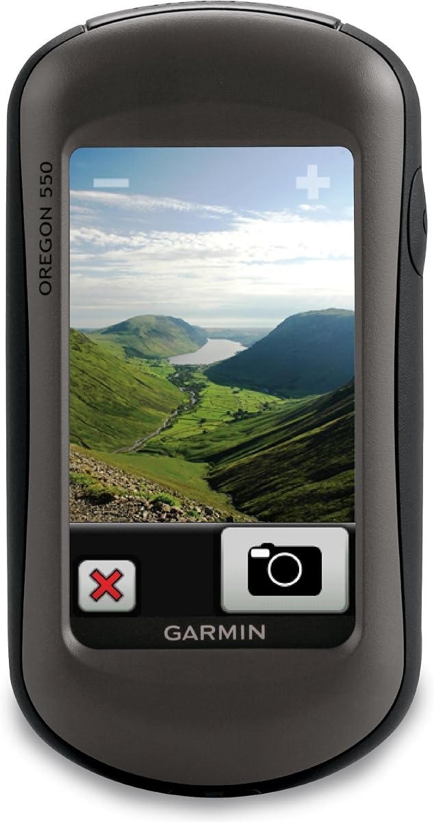
The Garmin Oregon 550 is a rugged device that excels in display quality and sensor accuracy. It includes a 3-inch color touchscreen that is easy to read and provides a responsive interface for selecting points on the map.
We may earn a commission when you buy through this link, at no additional cost to you.
Its 3-axis tilt-compensated electronic compass ensures accurate headings even when the device is not held level. The barometric altimeter tracks pressure changes to help you anticipate weather shifts during long outdoor sessions.
It comes preloaded with a worldwide basemap and shaded relief for better terrain visualization. While it lacks the T suffix which usually denotes specific camera features it still serves as a solid navigation tool for various terrains.
Choose this model for its reliable sensors and clear screen if you do not need advanced camera features. It is a durable option for outdoor enthusiasts who prioritize data accuracy and map clarity.
This compass gives you accurate directional data even if you tilt the device which is helpful when reading maps on uneven ground.
The shaded relief on the map helps you distinguish between hills and valleys quickly without needing to interpret contour lines.
We may earn a commission when you buy through this link, at no additional cost to you.
The Garmin Oregon 200 is a compact portable GPS system designed for quick and easy navigation on the go. It features a 2.6-inch color TFT display that fits well in one hand for convenient use while walking.
We may earn a commission when you buy through this link, at no additional cost to you.
It utilizes a high sensitivity GPS receiver to maintain a reliable signal even in difficult areas. The device supports up to five user profiles allowing you to switch between different activity types like fitness or geocaching easily.
While it is an older model with a lower user rating compared to newer units it still offers basic functionality that works well for simple caching tasks. The rugged touchscreen technology ensures the device can withstand accidental drops during use.
Consider this unit if you need a small and lightweight device that does not require advanced features. It serves as a functional entry point for those who want a dedicated GPS without the complexity of larger models.
The small form factor makes it easy to slip into a pocket or backpack pocket for quick access when you need directions.
Multiple user profiles let you optimize settings for different activities so your GPS adapts to your current use case.
We may earn a commission when you buy through this link, at no additional cost to you.
Selecting the right device requires understanding key factors like display quality, battery life, and mapping capabilities. This guide breaks down the essential features you should prioritize for your geocaching adventures.
A clear and bright display is critical for reading maps outdoors. Look for screens that are sunlight-readable and have at least 2.2 inches of diagonal size. Color screens generally offer better contrast for map features than monochrome ones.
Prioritize a large bright screen that remains visible even when you are in direct sunlight during the day.
Consider how long the device lasts on a single charge or battery set. Some models offer over 20 hours of continuous use which is ideal for all-day hikes. Rechargeable batteries are convenient but AA batteries offer easier swaps in remote areas.
Choose a power source that matches your trip length and ensure you have backups for long expeditions.
Multi-GNSS support improves accuracy by using multiple satellite systems like GPS GLONASS and Galileo. This is vital for dense forests or deep canyons where a single system might struggle to find a lock.
Look for models with multi-satellite support to ensure reliable positioning in challenging environments.
Internal memory determines how many maps you can store on the device. A microSD card slot allows you to expand storage significantly which is helpful if you travel to different regions. Check if the device comes with preloaded topo maps.
Ensure the device has ample storage space or an expansion slot for your regional map needs.
Geocaching often involves rough terrain and unpredictable weather. Look for devices with a waterproof rating of IPX7 or higher to protect against rain and splashes. Rugged build quality ensures the unit survives accidental drops.
Select a unit with a high waterproof rating and sturdy construction to withstand outdoor elements.
Some units include a barometric altimeter or a digital compass which can be very helpful for navigation. The altimeter tracks changes in pressure to help you monitor altitude and weather conditions while the compass gives accurate headings.
Prioritize models with extra sensors if you need altitude data or precise directional tracking.
Wireless connectivity allows you to update software and download new maps directly from your smartphone. Bluetooth or Wi-Fi support is useful for staying current with the latest cache data and weather forecasts without a computer.
Opt for devices with wireless connectivity to simplify updates and data syncing during your trips.
Physical buttons offer better control than touchscreens when wearing gloves or using the device in rainy conditions. However touchscreens are intuitive and faster for navigation. Choose a layout that suits your preferred interaction style.
Decide between buttons and touchscreens based on your typical outdoor conditions and usage habits.
Always charge your device or replace batteries before heading out to ensure it remains powered throughout your search. Download your maps and cache details ahead of time so you have access even when offline in remote areas.
Use the waypoint feature to mark your starting position and any cache locations you find. Regularly save your track log to document your path which can be helpful for retracing your steps if needed.
Store your GPS in a protective case when not in use to prevent scratches and damage. Keep the lens and screen clean and dry to maintain visibility and sensor accuracy over time.
Most devices do not require a subscription for basic functionality. However premium features like satellite imagery might have limited free trials. Always check the specific device details before purchasing.
Modern GPS units with multi-GNSS support can achieve accuracy within a few meters. This level of precision is usually sufficient for finding standard caches in open terrain and wooded areas.
While smartphones work well in many cases dedicated units offer better battery life and signal in remote areas. They are also more rugged and waterproof which makes them safer for harsh outdoor conditions.
The terms are often used interchangeably but GPS units generally focus on outdoor navigation. They offer more durable designs and specialized maps compared to standard car navigation systems.
Most modern devices support wireless updates via a smartphone app or USB connection to a computer. You can download map files from the manufacturer's website and transfer them to the internal memory.
AA batteries are easier to replace in the field but rechargeable batteries offer cost savings over time. Consider your access to power sources and how long you plan to stay away from civilization.
Touchscreens are intuitive but buttons are more reliable when your hands are wet or gloved. If you expect harsh conditions buttons might be the safer option for critical navigation tasks.
Eight gigabytes is usually enough for several regional maps. If you plan to download many detailed maps a device with expansion via microSD is highly recommended.
We have explored ten reliable handheld GPS units that cater to different needs and budgets. Whether you choose the durable eTrex 22x or the feature-rich Montana 680 each device offers unique strengths for your outdoor adventures.
Prioritize factors like battery life and map quality based on your typical hiking conditions. A device that offers good connectivity and durable build will serve you well over many seasons of exploration.
Remember to check the latest prices and features as models evolve quickly. With the right GPS in hand you can navigate with confidence and enjoy every moment of your geocaching journey.