
Garmin eTrex SE
4.2Editor score
168 hour battery life
Multi-GNSS support
Water-resistant design
Choosing the right GPS device is crucial for anyone planning to hike the Appalachian Trail. A reliable navigator helps you stay on course, track your progress, and ensures safety in remote areas where cell service is scarce or nonexistent entirely.
We evaluated ten top-rated products including rugged handheld GPS units and essential trail guides. Our comparison focuses on battery life, display readability, map accuracy, and durability to help you find the best tools for your journey.
Each pick highlights key features and real-world performance data from verified users. Please note that pricing fluctuates frequently, so check current listings before purchasing to ensure you get the best value for your specific needs.
4.2Editor score

4.6Editor score

4.6Editor score
As an Amazon Associate we earn from qualifying purchases.
The following table provides a side-by-side comparison of all ten products reviewed in this guide. It highlights key specifications to help you quickly identify the device that best matches your hiking style and budget requirements.





The Garmin GPSMAP 65s stands out as the top choice for serious Appalachian Trail hikers needing precision and reliability. With a 4.6 rating from users, it offers a large 2.6 inch color display that is easily readable even under bright sunlight. Its multi-band technology ensures you maintain a strong signal in dense forests or deep canyons common along the trail.
We may earn a commission when you buy through this link, at no additional cost to you.
Key strengths include the expanded global navigation satellite systems support which allows for optimal accuracy in challenging locations. The device includes routable TopoActive mapping and federal public land maps which are essential for navigation across the vast trail network. The 3-axis compass and barometric altimeter provide essential data without needing to constantly check maps.
While it is more expensive than entry-level models, the trade-off is justified by the superior performance and durability. The weight is slightly higher than minimal GPS units but remains manageable for long-distance hiking. Most users find the extra features worth the minor increase in pack weight during their journey.
This device is ideal for hikers who prioritize navigation accuracy and want a reliable tool for multi-day expeditions. If you are looking for a high-end navigator that can handle the toughest terrain on the Appalachian Trail, this is the recommendation to trust for your adventure.
The multi-band technology allows the device to pull signals from multiple frequencies reducing dropouts in dense canopy areas found on the Appalachian Trail.
Preloaded TopoActive maps and compatibility with the Garmin Explore website make it easy to plan routes and review statistics from the field.
We may earn a commission when you buy through this link, at no additional cost to you.
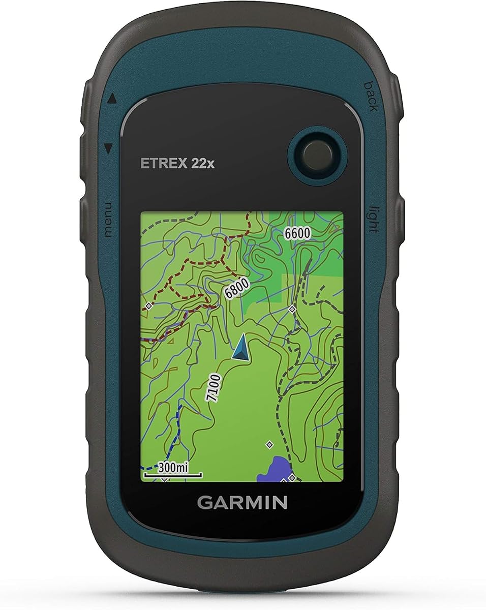
The Garmin eTrex 22x is a reliable handheld GPS that offers excellent value for hikers on a budget. With a solid 4.3 rating, it features a 2.2 inch sunlight-readable color display and comes preloaded with Topo Active maps. This makes it an excellent starting point for anyone planning to tackle sections of the Appalachian Trail without breaking the bank.
We may earn a commission when you buy through this link, at no additional cost to you.
Its key strength lies in its simplicity and durability. The device supports GPS and GLONASS satellite systems allowing for tracking in more challenging environments than GPS alone. You get 8 GB of internal memory for map downloads plus a micro SD card slot for additional storage needs. The battery life lasts up to 25 hours using standard AA batteries.
The main trade-off is the smaller screen compared to higher-end models which might be harder to read for those with vision issues. Additionally the processing speed is not as fast as newer devices. However for basic navigation needs this unit is fully capable and handles the trail conditions well.
This model is perfect for weekend warriors or thru-hikers who want a dependable backup GPS. If you need a rugged device that does the job without extra bells and whistles, the eTrex 22x is a smart choice to include in your gear list.
Preloaded routable roads and trails make it simple to find your way back or plan a new route during your trip.
Support for GPS and GLONASS ensures you have a strong connection even in dense forests or steep terrain.
We may earn a commission when you buy through this link, at no additional cost to you.
The Garmin Foretrex 401 is a compact GPS unit that packs premium features into a small package. With a high 4.6 rating, it is designed for hikers who need reliability without the bulk of a large handheld. Its high-sensitivity GPS receiver with HotFix improves performance in heavy tree cover common along the Appalachian Trail.
We may earn a commission when you buy through this link, at no additional cost to you.
Key strengths include the TracBack feature that retraces your path on the display ensuring you can return to your starting position easily. It keeps track of routes tracks and waypoints and supports dual position readout. The device also features an electronic compass and barometric altimeter which are vital for elevation changes on the trail.
The main downside is the small 1.42 inch display which may be difficult to read in bright light. The resolution is lower than modern units. However the unit's waterproof design and long battery life make it a robust choice for serious hikers prioritizing function over screen size.
This unit is ideal for hikers who want a lightweight and discreet navigation device. If you value advanced features like HotFix and TracBack in a small form factor, this is an excellent premium choice for your next hike.
HotFix satellite prediction helps you get a fix quickly even in heavy tree cover or deep canyons.
TracBack automatically retraces your steps using your GPS track log so you never lose your way back.
We may earn a commission when you buy through this link, at no additional cost to you.
The Garmin eTrex 32x is a rugged handheld GPS navigator that offers enhanced sensors for serious navigation. Rated 4.2 stars by users, it features a 2.2 inch sunlight-readable color display. It includes both a 3-axis compass and a barometric altimeter making it more versatile than basic models for elevation tracking.
We may earn a commission when you buy through this link, at no additional cost to you.
Its strengths lie in its comprehensive sensor suite which helps maintain accuracy even when stationary. The device supports GPS and GLONASS satellite systems for better tracking in challenging environments. With 8 GB of internal memory plus a micro SD card slot you can load plenty of maps for your trip along the trail.
One trade-off is that it lacks some of the newer connectivity features found in recent models. The interface feels dated compared to modern smartphones. However for pure navigation function the sensor accuracy is top-notch and justifies the choice for traditionalists.
This device is perfect for hikers who need reliable elevation data and a strong compass without paying for smart features. If you want a solid navigator with proven sensors, the eTrex 32x is a dependable option to consider.
The barometric altimeter provides accurate elevation data essential for monitoring your progress on steep sections.
The 3-axis compass ensures accurate heading even when the device is not moving.
We may earn a commission when you buy through this link, at no additional cost to you.
The Garmin eTrex SE is designed for endurance with an impressive battery life that can last up to 168 hours in standard mode. With a 4.2 rating it features a high-resolution 2.2 inch display. It supports Multi-GNSS including GPS GLONASS Galileo and more to track in challenging environments effectively.
We may earn a commission when you buy through this link, at no additional cost to you.
Its strengths include the ability to pair with the Garmin Explore app for software updates and trip planning. The automatic cache updates from Geocaching Live add convenience for users interested in geocaching. The water-resistant design rated to IPX7 allows you to hike in any weather without worry.
While the features are simplified compared to higher-end units, the focus on battery life and connectivity is strong. The trade-off is less internal storage for maps. However for a lightweight long-term hiking solution, the battery endurance makes it a very competitive option.
This model is ideal for thru-hikers who need a GPS that lasts for days on a single charge. If you want a device that keeps going and integrates with your smartphone, this is a great choice to try.
With up to 168 hours of battery life you can hike for days without needing to recharge your device.
Pair with the Garmin Explore app for wireless software updates trip planning and smart notifications.
We may earn a commission when you buy through this link, at no additional cost to you.
This Handheld GPS offers a 3.2 inch sunlight-readable screen which is larger than many competitors. Rated 3.9 stars, it provides multi-GNSS support for superior positional accuracy within six feet. The device comes preloaded with USA Topo maps and has 32 GB of internal memory for additional map downloads.
We may earn a commission when you buy through this link, at no additional cost to you.
Its key strengths include a USB-C rechargeable battery that can provide up to 36 hours of battery life. The compact design is lightweight and easy to carry in a backpack. The 3-axis compass and barometric altimeter provide accurate heading data even when stationary during stops.
The trade-off is a lower rating compared to established brands which might indicate mixed user experiences. The build quality may not be as rugged as top tier models. However the screen size and memory capacity are attractive features for budget-conscious hikers.
This unit is suitable for hikers who prioritize screen visibility and storage capacity. If you want a GPS that is easy to read and charge, this model offers good value despite the lower ratings.
The 3.2 inch screen offers a bright and readable interface that helps you navigate with ease.
The rechargeable battery provides up to 36 hours of use on a full charge.
We may earn a commission when you buy through this link, at no additional cost to you.
The Appalachian Trail book is an essential resource for planning your journey along the trail. With a 4.8 rating, it is the only illustrated book officially published with the Appalachian Trail Conservancy. It includes a full-size removable copy of the official National Park Service map of the entire trail.
We may earn a commission when you buy through this link, at no additional cost to you.
Its strengths include more than 300 spectacular contemporary images and unpublished historical photos from the ATC archives. The foreword by Bill Bryson adds value for readers interested in the trail's history. Essays on topics ranging from conservation to day-by-day hiking experience provide deep insight.
The trade-off is that it is a physical book and not a digital navigation tool. It does not provide real-time GPS tracking. However it is an invaluable companion for understanding the trail's significance and planning your route effectively.
This book is perfect for anyone planning to hike the trail who wants to appreciate its history. If you want a beautiful reference guide and an official map, this is a must-have item for your pre-hike preparations.
The removable full-size copy of the official National Park Service map helps you plan your route with accuracy.
Over 300 images and historical photos inspire and educate you about the beauty of the trail.
We may earn a commission when you buy through this link, at no additional cost to you.
The Garmin eTrex 20x is a handheld GPS navigator with enhanced memory and resolution. Rated 4.3 stars, it features a 2.2 inch 65K color sunlight-readable display. It includes a worldwide basemap and supports GLONASS for quick and precise location locking even in heavy cover.
We may earn a commission when you buy through this link, at no additional cost to you.
Its key strengths include 3.7 GB of internal memory and a microSD card slot allowing you to load a variety of maps. The high-sensitivity WAAS-enabled GPS receiver with HotFix satellite prediction helps maintain its location even in deep canyons. The device is water-resistant making it suitable for any weather.
The trade-off is the limited internal memory compared to newer models with larger storage. You might need to rely on SD cards for extensive map data. However for a compact classic navigator, it remains a reliable choice for many users.
This model is great for hikers who want a proven device with good map loading options. If you need a reliable GPS that works well in tough terrain, the eTrex 20x is a solid option to use.
High-sensitivity receiver with HotFix helps you get a location fix quickly and maintain it.
MicroSD card slot lets you load a variety of maps including TOPO 24K and City Navigator.
We may earn a commission when you buy through this link, at no additional cost to you.
Grandma Gatewood's Walk is a biography of the woman who saved the Appalachian Trail. With a 4.6 rating, it tells the story of Emma Gatewood who walked the entire trail alone at age sixty-seven. The book won the 2014 National Outdoor Book Award in History Biography and serves as deep inspiration.
We may earn a commission when you buy through this link, at no additional cost to you.
Its strengths include the unique perspective of the first person to walk the trail twice and three times. The book includes historic newspaper articles and Gatewood's own diaries and trail journals. The author Ben Montgomery provides detailed context on the trail's maintenance and history.
The trade-off is that it is a narrative book rather than a technical guide. It will not help you navigate but it gives deep motivation for your hike. The story highlights the beauty and challenges of the trail for future hikers.
This book is ideal for anyone dreaming of becoming a thru-hiker. If you want to understand the spirit of the trail and its history, this is a perfect read to prepare your mindset for your hike.
The book provides a detailed look at the history and significance of the Appalachian Trail.
Grandma Gatewood's personal journey inspires hikers to push past boundaries and challenges.
We may earn a commission when you buy through this link, at no additional cost to you.
101 Classic Hikes of the Northeast is a guide leading you to the best outdoor experiences in six northeastern states. With a 4.5 rating, it features 101 detailed maps and 140 stunning color photographs. This resource helps both novice and experienced hikers plan their next adventure in the region.
We may earn a commission when you buy through this link, at no additional cost to you.
Its strengths include expert guidance and professional photography that show you the scenic locations of the area. The book covers trails in Connecticut Rhode Island New York Massachusetts Maine and Vermont making it great for local hikes. It helps you choose trails that suit your skill level.
The trade-off is that it does not cover the full Appalachian Trail which extends beyond the northeast. It focuses on regional highlights. However for pre-hike training or exploring local sections it is a highly useful and informative guide.
This book is suitable for hikers who want to explore trails in the northeast region. If you want a curated list of top hikes with detailed maps, this guide will help you plan your local adventures effectively.
The guide includes 101 detailed maps to help you navigate specific trails with confidence.
Expert tips help you discover the most scenic and rewarding trails in the northeastern region.
We may earn a commission when you buy through this link, at no additional cost to you.
Selecting the right GPS requires evaluating several key factors to ensure safety and convenience on the trail.
A sunlight-readable screen is critical because you will often be hiking under bright skies. Look for displays that are clear without glare and have enough contrast so you can read maps easily without squinting.
Prioritize larger screens or those with high brightness settings for better visibility outdoors.
Long battery life is essential for multi-day hikes where charging opportunities are rare. Many devices offer replaceable AA batteries which make it easy to carry spares in your pack instead of relying on built-in rechargeable cells.
Check the rated hours and aim for devices that can last at least 20 to 50 hours depending on your needs.
Ensure the device comes with preloaded topographic maps that include the Appalachian Trail. Some units require subscriptions for premium data so verify if the maps are included out of the box to avoid extra costs.
Topographic detail helps you understand elevation changes and terrain features along the trail.
A rugged design is necessary to withstand drops moisture and rough conditions. Look for water resistance ratings like IPX7 or IP67 which protect the device from rain and accidental submersion.
Choose models with reinforced frames or protective cases for added longevity during your hike.
Support for multiple satellite systems such as GPS GLONASS and Galileo ensures you maintain a signal in dense forests or deep canyons. This multi-GNSS capability improves positional accuracy significantly.
Look for devices that explicitly state dual or multi-system support for the best reliability.
Physical buttons are often preferred over touch screens when hiking with gloves or wet hands. A simple interface allows you to navigate quickly without fumbling through menus while moving.
Opt for intuitive controls that let you access waypoints and tracks with minimal effort.
Before your hike, fully charge the device or insert fresh batteries and test it at home to ensure it connects to satellites correctly. This pre-trip check prevents issues when you are already on the trail.
During your hike, use the waypoints feature to mark trailheads campsites or water sources so you can easily navigate back to them. Regularly check the battery level and switch to power-saving mode if needed to extend usage.
After your hike, clean the screen with a soft cloth to remove dirt and moisture and store the device in a dry place. If the unit has replaceable batteries remove them if storing for long periods to prevent corrosion.
A GPS tracks your location but does not send messages so a satellite messenger is recommended for emergencies. However for basic navigation a standalone GPS unit is sufficient if you share your itinerary with someone trusted.
Smartphones can work with offline maps but they lack the battery life and ruggedness of dedicated GPS units. For long hikes a dedicated GPS is safer and more reliable in remote areas without cell service.
GPS uses satellites from the US network while GLONASS uses the Russian network. Using both systems increases the number of satellites your device can connect to improving accuracy and signal strength.
Most reputable GPS units include accurate topographic maps that cover the trail. However always check for updates or additional maps to ensure you have the latest trail information and conditions.
Battery life varies by model but many handheld GPS units offer between 20 to 50 hours on a single charge or battery set. Some models can last longer in power-saving modes for extended expeditions.
Yes waterproofing is crucial since rain and accidental drops in water can occur on the trail. Look for IPX7 or higher ratings to ensure your device survives wet conditions without damage.
We reviewed ten products ranging from rugged handheld GPS units to inspiring trail guides to help you prepare for your hike. The Garmin GPSMAP 65s stands out for its premium features while the eTrex SE offers excellent battery life for budget-conscious hikers.
When choosing a device prioritize display readability and battery life to ensure you can navigate safely without interruption. Also verify that the device supports multiple satellite systems for accuracy in difficult terrain.
Remember that prices change frequently and inventory fluctuates so check current listings before purchasing to get the best value. With the right tools you can enjoy your time on the Appalachian Trail with confidence and peace of mind.